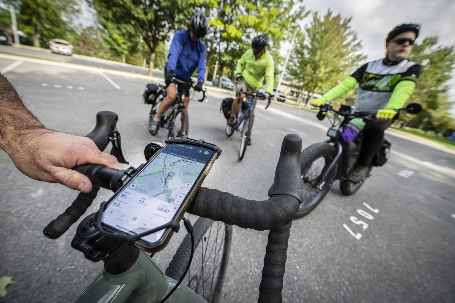
CentreBike’s Happy Valley Ride with GPS offers turn-by-turn navigation. (Photo by Darren Andrew Weimert)

 Menu
Menu
CentreBike’s Happy Valley Ride with GPS offers turn-by-turn navigation. (Photo by Darren Andrew Weimert)
This past summer, after much deliberation, I finally bought myself a new gravel bike. This is my first “serious” bike, and I love it. Its versatility allows me to tackle both pavement and gravel roads, along with the occasional mild trail. Riding gives my creaky knees a break from all the pounding of running and hiking, and it is just all-out fun.
While there are many different routes for biking in Centre County, to start I’ve been sticking to a few that I know. But I’m ready to branch out and really explore; I just wasn’t sure where to go. Well, wouldn’t you know, there is an app for that: CentreBike’s Happy Valley Ride with GPS.
CentreBike is a nonprofit founded in 2000 as a coalition of cyclists with a vision of making the State College area more bike-friendly. Its work includes bicycling advocacy, rider education, bicycling safety and awareness, and encouraging riding opportunities for all ages.
The Happy Valley Ride with GPS is the organization’s latest effort. It came about with a grant from the Happy Valley Adventure Bureau. From the Happy Valley Ride with GPS website (rides.centrebike.org), riders can download the app and choose from a number of routes. Use of the app is free while navigating one of the Happy Valley rides.
For road warriors, there are long and short rides that lead bikers on beautiful tours of the area’s many country roads. There are routes that lead riders on the back gravel roads of our many state parks and forests. Town rides lead bikers leisurely around town and through parks and the Penn State campus. And for those who are looking to get off-road, mountain-bike rides show some of the classic trail routes for which the area is so well known.
There are rides that take bikers out to Penn’s Cave or to the Boal Mansion for tours so that bikers can make a day of it. Rides often pass by local restaurants and interesting sites, allowing for rest and refreshments.
Through a rider’s phone, the app offers turn-by-turn navigation. Maps are downloadable to phones, so riders don’t need to use data and the information stays available in areas where cell service might be spotty.
Seems like the perfect way to explore Happy Valley to me, so on a beautiful fall day at the end of September, CentreBike Treasurer Paul Rito met up with me to take a ride and show me the ropes. Paul spent a lot of time during the pandemic putting Happy Valley Ride with GPS together.
We were joined by CentreBike President Matthew Cox and volunteer Dana Miller to ride the Little Trail Loop around State College and the Penn State campus. Before we met at the old visitors center building near Beaver Stadium (beware that parking at the center is now regulated by Penn State), I downloaded the Ride with GPS app, which was pretty simple.
Then from the website I found the Little Trail Loop, clicked to get the route, and it opened up in the app. Even before we got going, the map was already cool to look at. It showed our route with an elevation profile and milage count. Our 8-mile lollipop trip was going to have us climb 371 feet and take us through the Arboretum, the golf course, and campus. A little fork-and-knife icon on the map indicated that we were going right past the Penn State Berkey Creamery. When I clicked on it, it provided a brief history of the Creamery, with a link to the website. Cool. A cone would be the perfect way to end a nice ride.
Paul had an extra mount for my phone and strapped it on my handlebars before we got going. I hit navigate and we were off. True to form, the app provided turn-by-turn navigation for our route.
Dana says that while developing the routes, they made sure to provide specific directions to help people like her who might be a little directionally challenged.
“This is going to be a really good tool for people who don’t have a sense of direction. It gives me much more confidence going out on a bike ride knowing that I am not going to get lost,” she says.
After leaving the old visitors center, we traveled up Porter Road and then down Curtin Road. We then turned right on University Drive and headed out to Big Hollow Road and down the hill toward the Bellefonte Central Rail Trail, which cuts across the lower part of the Penn State Arboretum grounds. It was beautiful taking in the nature and chatting with my fellow riders.
From there, Paul told me to drop the bike into a low gear as we climbed the hill up to Sunset Park. Whew, that is a good workout. The app then led us through some side streets in College Heights, dropping us down to Cherry Lane, where we crossed North Atherton Street and continued past Radio Park Elementary School to the Circleville to Penn State Bike Path.
From there we took the bike path that cuts across the golf course, before heading back across West Campus, across Atherton, back up to Curtin and back to home base. It was a nice, scenic ride that was mostly on trails, bikes paths, and low traffic roads, and the app was easy to follow. The app alerts you before every turn, and if you happen to go off course, it lets you know quickly how to get back on track. Punch up a route from home and it will give you directions to the starting point.
Paul says CentreBike is working to add more routes to the website, but there are already plenty of options to explore. Community feedback is appreciated, he says.
Bikers should practice safe riding techniques, he says, and CentreBike offers classes and has other resources to help people learn the rules of riding. I learned a few things just while I was out with Paul; he pointed out every potential obstacle while I was riding behind him to make sure that I saw them.
Now that I have some direction, I plan to get out there and explore more of Centre County. All I need now is a mount for my phone and some good weather.