PennDOT has made minor changes to two of the proposed routes for the State College Area Connector project, the department said on Wednesday.
The adjustments to the central and north alternatives are intended to reduce potential environmental impacts along the planned 8-mile, four-lane limited access road in Potter and Harris townships, connecting U.S. 322 at Potters Mills and the Mount Nittany Expressway near Boalsburg,
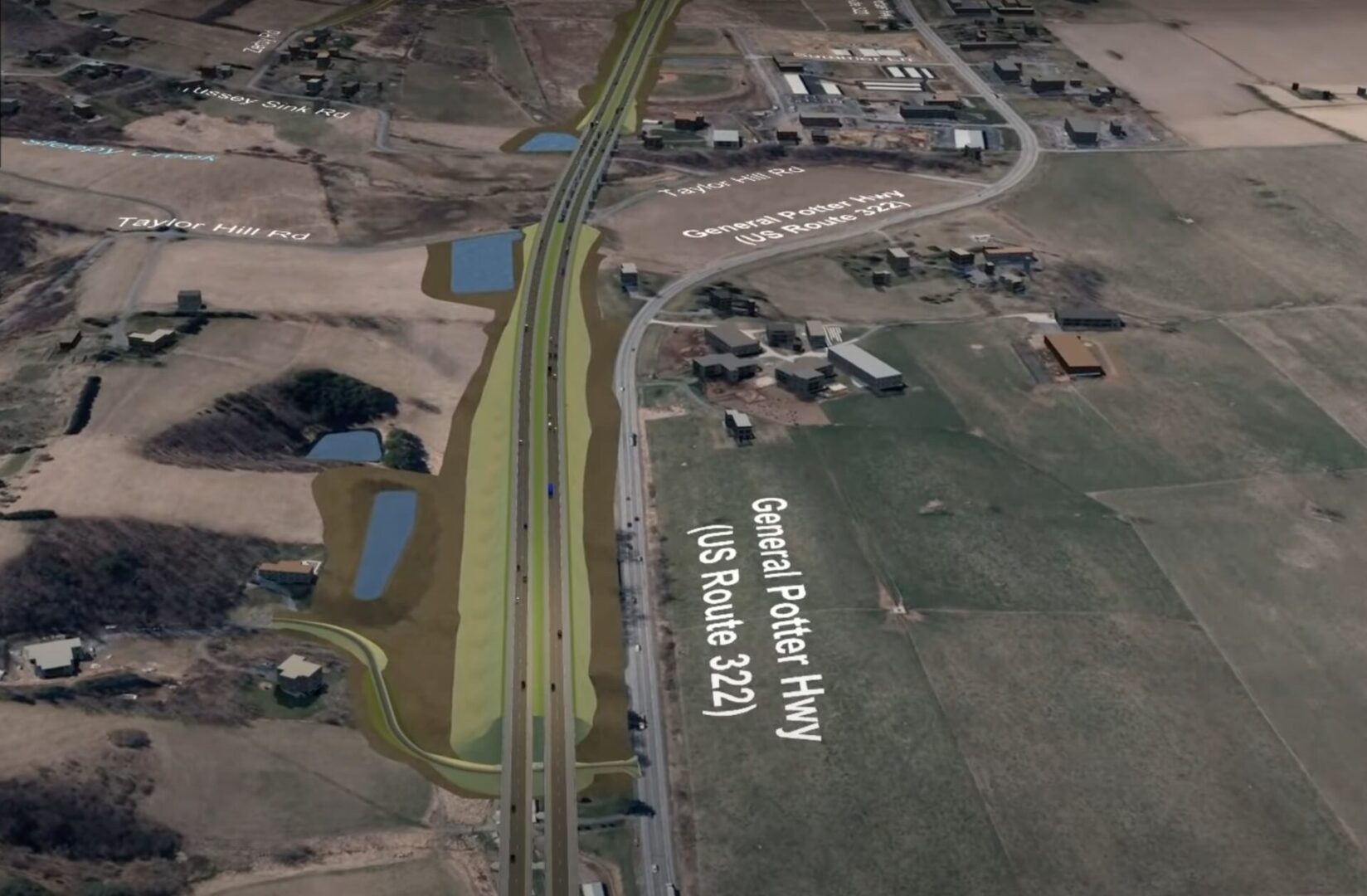
For the central alternative, which PennDOT identified in May as the preferred route for the project, the design team has shifted a small segment south to minimize impacts on the Potter Township Athletic Complex and avoid directly impacting its baseball fields. The move also reduces impacts on a farming operation, according to a release.
The central alternative would start just west of the existing Potters Mills Gap, continuing mostly along and to the south of the U.S. 322 corridor for 2.4 miles. It would then turn north just past Tussey View Lane, crossing over Spring Creek and Sharer Road, then turn back south before merging in the area of the existing U.S. 322 near Somerset Drive. (A fly-through video released in May prior to the adjustment shows the route in detail).
A change to the north alternative near Wagner Road relocates a proposed stormwater management facility to avoid impacting a historic property that contributes to the Penn/Brush Valley Rural Historic District, PennDOT wrote.
No changes were made to the south alternative, the third route under consideration.
As the next step in the process, Draft Environmental Impact Statement, which PennDOT expects to be released for public comment later this year, will evaluate each of the alternatives. A public hearing on the DEIS also will be held.
The final Environmental Impact Statement and Record of Decision are anticipated in June 2026.
Pending approval by the FHWA, the project will then move into the final engineering design phase. That will be followed by right-of-way acquisition and, finally, construction, which is not expected to begin until 2030 and will take about five years to complete.
According to documents published in May on the SCAC website, the recommended central alternative would displace 16 residences, the fewest of the three options. It would also impact 19 farms totaling 163 acres — the smallest in terms of acreage among the three — and two commercial properties.
A single-point urban interchange, “where all off and on ramps come together at a common intersection with the cross street,” is proposed to replace the existing Route 45 interchange. “By
eliminating one intersection, operational efficiencies, including reduced delay, congestion, and vehicle queuing, as well as enhanced safety, can be realized,” PennDOT wrote in a summary published in 2024.
The project also would include working with Harris Township to develop a shared-use path on local 322/Boal Avenue from Discovery Drive to Bear Meadows Road.
The alignment avoids the headwaters of Spring Creek and the Tusseyville Historic District and impacts the fewest number of historic properties, according to PennDOT. It also has the lowest potential for encountering acid-producing rock.
The lone “con” listed by the department for the central alternative is the need to construct multiple bridges to avoid or minimize stream and wetland impacts.


