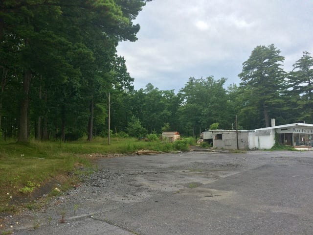
The proposed plan for the former Penn State Mobile Home Park site and adjacent properties on North Atherton Street would have a ‘downtown’ feel, developers said at last week’s Patton Township Board of Supervisors meeting.
The mixed-use development on 30 acres of currently unused and undeveloped land is known as Patton Crossing and was first brought to the township in March. Since then, discussions have been ongoing between the group developing the property, 1752 North Atherton Associates, and the Planning Commission.
‘We looked at trying to create a town center where you live, work and play in the same area,’ said Bob Poole, one of the partners in the development group. ‘This is somewhat of a downtown concept.’
Plans call for a grocery store, hotel, mixed-use residential and commercial buildings and commercial and office buildings with a large central plaza.
The plaza would be a focal point of the development, Poole said.
‘The concept of this plaza is where social activities would occur, where people would gather,’ he said. ‘There would be a lot of eateries on the corner where you can sit outside. We have it laid out so you can block off this area and it can be used for festivals.’
Currently planners and the developers are working on a new zoning overlay district that would allow the proposed uses. The first 150 feet of the land off of North Atherton Street is zoned commercial with the rest zoned R-2 and R-3 for multi-family residential housing.
‘We don’t really have zoning regulations that quite address something like this,’ Planning Commission member John O’Neill said.
Because the township doesn’t have a zoning district to permit a mix of residential and non-residential on a large lot, planners are working on a model that would rezone the underlying land C-2 planned commercial with a new mixed-use overlay district 2 (MXD2) that would fit with the plans and would promote a mix of land uses and redevelopment of underused properties in the township.
The overlay would allow for increased building heights. Current C-2 and R-3 height limits are 50 and 60 feet, but the overlay would allow for up to 80 feet.
‘There’s generally support for this because these higher heights would have greater setbacks from the front of the property ranging from 100 to 200 feet from the front,’ O’Neill said.
The 80 foot height limit, which could only be used on 10 percent of the site, would be more than 200 feet from the front of the property and would allow for the hotel and a landmark feature, currently designed to be a clocktower.
Poole noted that the building heights rise moving toward the back of the property.
Preliminary plans have a 130-room hotel with six stories, including 5,000 to 7,000 feet of conference space. Poole said the group has an agreement with a grocery store for another of the proposed buildings.
The residential buildings would not be for student housing and would include about 400 units, with a mix of efficiencies, one- and two-bedroom apartments. The MXD2 would require 5 percent, or 20 units, to be inclusionary housing.
Concept plans show a community center and swimming pool, as well as two one-story parking decks. Ara Kervandjian, another partner in 1752 North Atherton Associates, said an additional level could be added to each if a need was determined. He said in total the plans call for about 1,600 parking spaces on the site, with most of it near the rear of the property.
The site would have pedestrian connectivity to nearby neighborhoods and parks. The site itself includes 2.1 acres of undeveloped park land which could be integrated into the development, O’Neill said.
The MXD2 would require 2 percent of the land, or about .6 acres, to be public gathering space.
Several residents of Park Lane, while generally supportive of the project, expressed concerns about traffic impact on their street and other Park Forest neighborhood streets. The development as currently designed would have access from North Atherton Street and Park Forest Avenue.
Left turns from Park Forest Avenue to go north on North Atherton Street are no longer permitted, and residents are concerned that drivers coming from Patton Crossing would begin using Park Lane and other residential streets to navigate back on to North Atherton northbound.
‘My concern is that we’re taking commercial traffic and dumping it into a residential neighborhood,’ said resident Lyn Pipenberg.
The developers are currently conducting a traffic impact study that will inform decisions going forward, Poole said, adding that they had spoken with the project’s traffic engineer about looking into the possibility of realigning some intersecting streets..
Supervisor George Downsbrough said the project and the traffic impact study provide potential for better access to North Atherton Street.
Pipenberg also said the site currently has a number of mature trees and she would like to see shade trees remain part of the property, both to match with the Park Forest neighborhood and to provide a comfortable atmosphere in the public gathering space.
Supervisor Jeff Luck said that the township encourages developers to maintain as much of a forested area as possible, but state law prohibits making it a requirement.
Dick Repsher, also a Park Forest resident, said he wasn’t against the idea of having festivals but asked if it was really a need for that development as such events would further impact traffic.
Kervandjian responded that festivals weren’t necessarily a focal point of the development, but that the group is trying to extend the concept of a year-round town center with a downtown feel.
No decisions have been made as of yet related to zoning and permitting, and last week’s meeting was an opportunity to gather information and start hearing from the public, Supervisor Elliot Abrams said.


