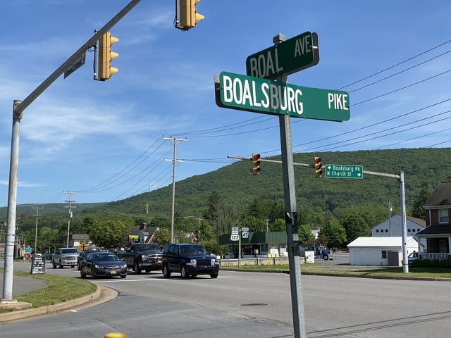
A stretch of Boal Avenue may soon be going on a “diet,” slimming down to two lanes to improve safety and to make way for a bike lane on a gateway road to the Centre Region.
Harris Township recently completed a study to determine the feasibility of such a project; an update for that study was presented to the township’s Board of Supervisors on June 8.
The “road diet” is part of Boalsburg’s Small Area Plan, and was designed to improve the functionality of Boal Avenue, while balancing the needs of pedestrians, bicyclists and the motoring public. The project is also in concert with the Centre Region Bike Plan.
Rob Watts of the civil engineering firm McCormick Taylor is putting the finishing touches on the study.
“We wanted to find out if we could take out that lane without it being a fatal flaw,” he said. “We determined that we could do it and have good traffic flow.”
The intent of the “road diet” is to improve safety by adding a turn lane in the middle of the roadway and adding a bike lane on one side of the road. The middle turn lane would provide a turning area that is not a traffic lane, which tends to be “a little crash-prone,” said Watts.
The “diet” is designed to begin just after the Pennsylvania Military Museum driveway and continue about a half-mile to Earlystown Road.
“We did not want to get too close to the Military Museum driveway or Warner Boulevard. The design gets much more complicated as you have culverts and you have event traffic. We wanted to have enough room for event staff to work with,” said Watts.”So we decided to start the road diet a little to the east of the Military Museum driveway.”
The bike path will make a connection to the current and future bike path in the Centre Region Bike plan.
“This is kind of the next step in making connections in the bike network,” said Watts.
Traditional bike lanes are located on both sides of the road with no buffers.
A potentially safer option would be to include a protected two-lane bike path on one side of the road that is 10-feet wide with a 2-foot buffer from traffic. This would prevent people from using the shared-use bike path in front of the Military Museum and from crossing Boal Avenue at the stop light.
“This creates more of a continued shared-use path experience for riders, if we keep the lanes on the north side of Boal Avenue through this area, which has the fewest number of driveways by far, and Spring Creek, to keep development from getting in there,” said Watts. “It would be a safer arrangement.”
The township, instead of PennDOT, would have to assume more of the cost of maintenance of the protected bike lane.
Township Supervisor Amy Farkas said the cost is a concern and she plans to speak dollar figures with a colleague who maintains a protected bike path in another township.
Farkas said the goal was to complete the project when PennDOT planned to repave Boal Avenue, in order to save costs. That repaving was originally scheduled for 2021, but has been pushed back to 2022; thus, if the project is approved, that is when it will be completed.
Another concern the township needs to address before the plan is complete is what to do with the traffic signal at Route 45. Traffic making a right turn from Route 45 onto Boal Avenue currently goes through a “slip lane,” which allows it to continue without stopping.
“This conflicts with a bike lane,” said Farkas. The township must determine whether a more traditional right-turn traffic signal would be better suited.
There are also concerns about traffic queuing up to make turns at certain intersections.
The feasibility study kicked off in 2018 and is in the final stages. Supervisors noted it would be completed before a full concept plan will be displayed to the public and then voted on by the board. Farkas said she hopes the plan will be ready for a public session in three to four months.


