
Sometimes, no matter how much you enjoy being in the woods, hiking on well-worn paths can feel like a drag, like a march that you don’t need to be on.
So, every once in a while, I feel the need to spice things up and add a little bit of excitement, or maybe even a touch of danger, to a hike to make me feel alive.
Now, while I am no rock climber, out on ledges with a rope to (hopefully) save me in case of a mishap, I do enjoy a good scramble over rocky terrain that requires careful foot placement and maybe some crawling on all fours, but nothing so intense that a rope is needed. Yes, a nice rock scramble with great views is all the spice I need to make a hike exciting.
Around Centre County, there are a few such hikes that come to mind, such as the Shingletown boulders or the Stairway to Heaven near R.B. Winter State Park. But there is an even better hiking route in neighboring Clinton County that offers a scramble well worth the trip for an adventurous soul. Just be warned that the seven-mile hike is extremely challenging and includes 2,000 feet of elevation gain and difficult scrambling over rocky terrain. Of course, this is what makes it fun.
To get there, travel to the small town of Castenea, which is just outside Lock Haven. Follow Nittany Road toward the mountain until you end up at a closed gate with a few parking spaces. This is where you’ll start this adventure.
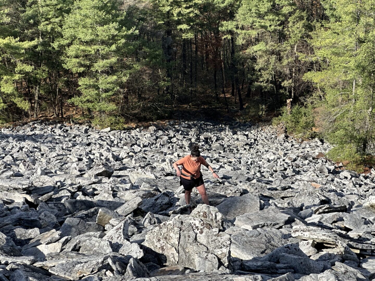
The boulder field can be seen from below, high up in the mountains. And from the gate it is a difficult three-mile hike to get to the start of the rock scramble.
I learned about this awesome area by participating in a trail race that included the boulder field as part of the course, now fittingly called the Boulder Beast.
I felt the urge to go out to the boulders to spice up my hiking on a beautiful October morning, but there was one problem: my usual hiking buddy, Peggy dog, was injured and out of commission for a while (hopefully she’ll be back on the trails soon).
Luckily, my friend Mark and his dog Dave (one of Peggy’s best friends) and my partner, Becky, were up to hiking the boulders with me.
Because of the challenging nature of the hike, I would never do the boulders without another hiker along. Mark was especially handy to hike with because he always makes sure to have the ten hiking essentials (see sidebar) with him on trips.

Especially important on a trip to the boulders is a map that you know how to read because, while the trails are established, they are not marked and sometimes can be difficult to navigate. If you are using an app like AllTrails, it is best to download the map before you get started and make sure your phone is charged.
Indeed, it was not long after we left the short path from the reservoir and started hiking up the first climb that I took a wrong turn on a wide path that intersected with the trail. Luckily, we quickly noticed our mistake and got back on track.
The 3.2-mile hike to reach the boulder field is daunting, climbing roughly 800 feet in the first mile before sending you back down just as far on a rocky, difficult-to-navigate trail. Dave was happy to be bouncing around in the fallen leaves, but all the humans were starting to drag a little as we continued on our trek … until we reached the boulders. This is where the fun starts.
Looking up from the bottom of the boulders, it is hard to understand how you are going to climb up the steep rocks. The view is deceiving, too, because this is just the start of the rock pile. The field of boulders continues on to the left, with 800 feet of climbing over three-fourths of a mile. Mark said it reminded him of a rocky hike he had done in Scotland. Although I had done this climb before, I was a little intimidated, but we weren’t turning back.
After a short break for a drink and a snack, we got to it. Once we started climbing, all the malaise on the way out turned into joy and wonder. Each step had to be navigated carefully, up over the boulders, but the rocks were surprisingly grippy. It was exhilarating as we negotiated our way up, following stakes that led us on the correct course.
After making our way up to the first ledge, I turned around, and was blown away by the view of the valley below. From the Susquehanna River flowing through Lock Haven to the ridges of the Pennsylvania Wilds in the distance, the view was just amazing. And it is there for hikers to view the whole way up. Anytime I got a little tired, I just turned around and exclaimed, “Wow!”
Some dogs might find the climb too challenging for their paws to manage, but Dave, who is an experienced mountain dog, climbed with ease (I was a little jealous of his extra two legs).
It was a mild day, but the fact that nights had been cold made me feel confident that rattlesnakes were not going to be an issue. Still, I kept my eyes peeled, because there have been many sightings of rattlers on the rocks in the past. Summer hikers need to be very mindful of our slithery friends.
Winter, too, can be a hazard, as ice and snow can make the climb extremely dangerous. Fall and early spring after the snow melt are my preferred times for this hike. A December hike before the first snowfall might be best attempted later in the day, after any slippery frost is off the boulders.
After taking in the sights, we made our way to the top of the ridge, and then we followed the trail down the back side of it. It is a steep hike down to the Kammerdiner Trail, and the fall leaves made it extra difficult to navigate, but once we made it to West Kammerdiner Run, it was an easy three-mile hike back to the reservoir and parking area.
It all makes for a fun day hike, with a little extra boulder-field spice. Just make sure you are prepared for this adventure, for it is not for the faint of heart. T&G
Vincent Corso loves exploring the outdoors in central Pennsylvania and beyond.


