With last month’s major tornado outbreaks, I decided to list the five greatest weather events I know about that combine meteorology and deviation from the normal. They all come from before the talk of global warming really got hot — four of them from the 1930s through the ’50s when we were in a similar pattern in the oceans and atmosphere to today’s.
So here we go.
Number 5: The Tornadoes
Think things are bad now? Think again. The strongest tornado years were in the 1970s, specifically the mid-’70s, led by the 1974 super outbreak in early April through the Ohio Valley. Also in the bunch, but coming up a bit short, was the late-May 1985 outbreak from Ohio into Pennsylvania and New York, the farthest-north super outbreak, as it extended into Ontario. In any case, given that these were farther north and before the time of the super detection systems we have now, they were as impressive as what we have just seen (remember, the recent ones were very far South).
Number 4: The 1954 Hurricane Season
Three major hurricanes, Carol (though some think it was only a Category 2), Edna and Hazel struck the East Coast during a seven-week period. One has to wonder why that hasn’t happened since.
Number 3: The Great Atlantic Hurricane of 1944
With a diameter of hurricane-force winds nearly 600 miles from west to east, and a storm going east of the Virginia Capes causing wind gusts of up to 156 mph out of the north at Cape Henry, the storm drove the boardwalk back to Baltic Avenue (if you’ve ever played monopoly, you would understand what happened).
Number 2: The Great Dust Bowl of the 1930s
Few things get me more fired up in the Anthropogenic Global Warming (AGW) debate than folks not understanding how bad the climate was in this country when the Pacific Ocean warmed in the 1930s and the Atlantic warmed also, as we have seen recently. What has happened up until now can’t compare with what happened then. If we had had the ability to measure it then the way we do today, some of the pronouncements on AGW would border on laughable if it weren’t such a serious policy debate. It was hotter and drier then. One can only imagine what, if we had the objective methods of today trained on the weather of the 1930s, we would have measured.
Number 1: The Great Hurricane of ’38
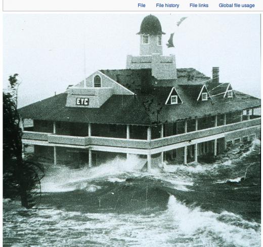
But my Number 1 weather event for extremity is the 1938 New England hurricane. The idea that a storm that strong could hit a place that far north simply boggles the mind. I still can’t believe it happened.
Providence, Rhode Island, 15 feet above sea level at almost 42 degrees north (we are not talking about New Orleans, with many places below sea level and an 85 degree body of water next to it) under 12 feet of water. Watch this and be amazed.
It’s a personal list, but evidence that ‘the good old days’ may not have been so good.