Penn State announced on Tuesday night that it will work with ClearWater Conservancy to explore ways to conserve 365 acres of university-owned land between Whitehall Road in Ferguson Township and Rothrock Forest at Musser Gap.
“Our vision for this area is to not only help protect the local water supply, plant and animal species, but also make it a place where people can enjoy nature, learn about the environment and be inspired,” Penn State President Eric Barron said in a news release.
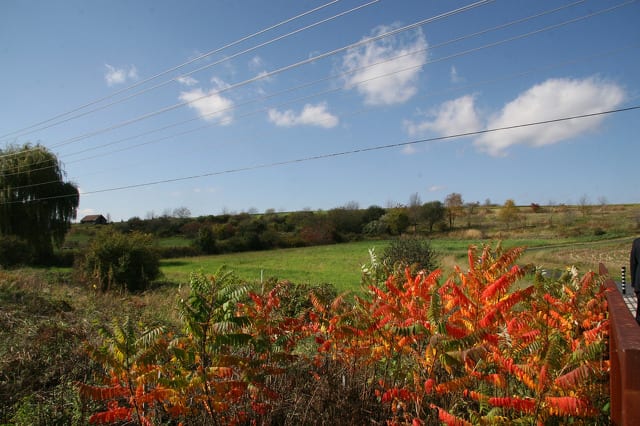
The property to be conserved is referred to as the Musser Gap to Valleylands (MG2V) site and includes the Musser Gap Greenway recreational trail, developed earlier this decade by Penn State and ClearWater to connect Rothrock to the planned Whitehall Road Regional Park. The future site of the park, which recently began development, and the forest border the MG2V site.
ClearWater will work with the community and seek input from residents.
“ClearWater is excited to partner with Penn State and engage our local community around this important initiative. Public input is key to shape future use of the MG2V site — not only for our community today, but for generations to come,” said Deb Nardone, executive director of ClearWater Conservancy. “We will be leading public engagement sessions and surveying stakeholders in the community beginning this January.”
The first public session will be held from 6 to 8 p.m. on Jan. 31 at the Unitarian Universalist Fellowship of Centre County at 780 Waupelani Drive
A team of Penn State graduate and undergraduate students spent the fall semester studying the site as part of an upper-level landscape architecture course and another class will continue that work in the spring, expanding the scope to work with ClearWater and others within and outside the university.
‘This project is all about providing both environmental and social benefits — which is what our department consistently strives to do,” said Eliza Pennypacker, professor and head of landscape architecture. “In this first phase of exploration, the students, led and mentored by some of our top faculty, have explored many aspects of the MG2V property, examining the biophysical, geological, hydrological, ecological, agricultural and historic characteristics of the land. This has resulted in a very useful profile of the site’s existing conditions.”
David Gray, Penn State senior vice president for finance and business, said the process will be ‘careful and deliberate,’ as an understanding of the ecological needs of the site and how best to conserve it is developed.
“We will consult extensively with the local community and government as we consider passive use options that help protect the overall environment, including the water supply, while advancing the university’s core missions of education, research and outreach,” Gray said.
The 365-acres to be conserved is portion of a larger original parcel extending from Whitehall Road to south of Route 45 that was acquired by Penn State in 1999 from the Mellon Family Trust and the Richard King Mellon Foundation.
In addition to developing the greenway, in 2014, Penn State sold 59 acres near Whitehall Road to State College Borough Water Authority (SCBWA) for restricted conservation. Between 2008 and 2011, the university sold 100 acres to Ferguson Township and the Centre Region Council of Governments for development of Whitehall Road Regional Park. And in 2012 Penn State entered an agreement with developer Toll Brothers for the sale of 45 acres at a cost of $13.5 million, with the condition that Toll Brothers would provide necessary infrastructure for Whitehall Road Regional Park.
Toll Brothers’ plans to build luxury student housing called The Cottages on the site were met with protests and legal action by residents who said the development would be detrimental to Slab Cabin Run and the nearby Harter-Thomas well fields, the source of drinking water for the majority of homes served by the SCBWA. The developer and Penn State said testing and requirements for the construction showed those concerns to be unfounded. Opponents also claimed Ferguson Township Board of Supervisors improperly approved Toll Brothers’ land development plans.
After the state Supreme Court declined to take up a final appeal by opponents of the development, Penn State and Toll Brothers closed on the sale in December 2017.
The 365 acres to be conserved, meanwhile, fits in with ClearWater’s ongoing efforts to conserve land along the Tussey Ridge and in the Spring Creek watershed. That has included acquiring the 423-acre Musser Gap and 280-acre Hale property, both of which were then conveyed to Rothrock State Forest.
ClearWater also completed a major fundraising effort last year for the Slab Cabin Run initiative to acquire conservation easements on the Meyer and Everhart farms in College and Harris townships, which also sit in a critical part of the Spring Creek watershed, adjacent to the Harter and Thomas wells.
Earlier this year, ClearWater officials said they are seeking a conservation easement to permanently preserve more than 100 acres of Hess Farm along Shingletown Road in Harris Township. Roaring Run, a tributary to Slab Cabin Run, travels through the property and the land is in SCBWA’s recharge area. It also is adjacent to Rothrock.


